
Navigate to the settings.
- Get “BLERTK” app from the App Store for iOS or Google Play for Android.
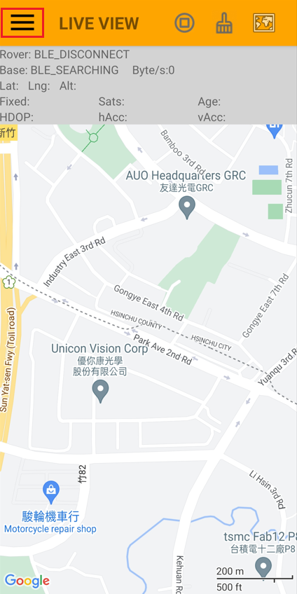
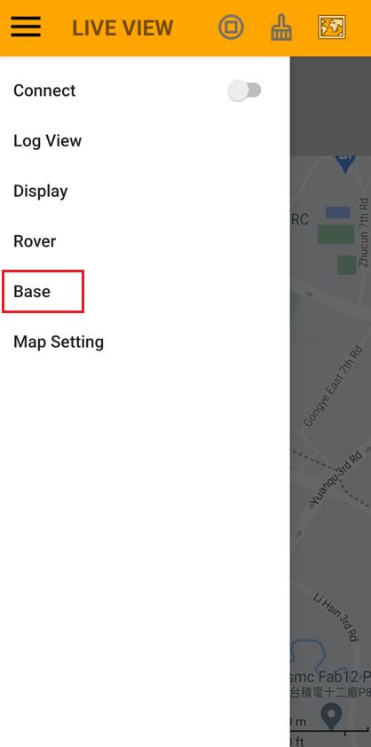
2. Open BLERTK and tap the menu icon to access additional features.
3. Click ”Base”
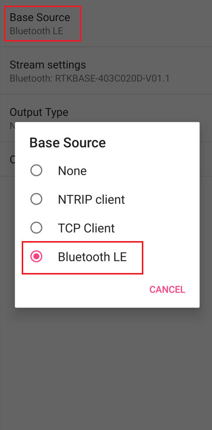
4. Click ”Base Source” to select “Bluetooth LE” as RTK Base source.
5. Click “Stream settings”
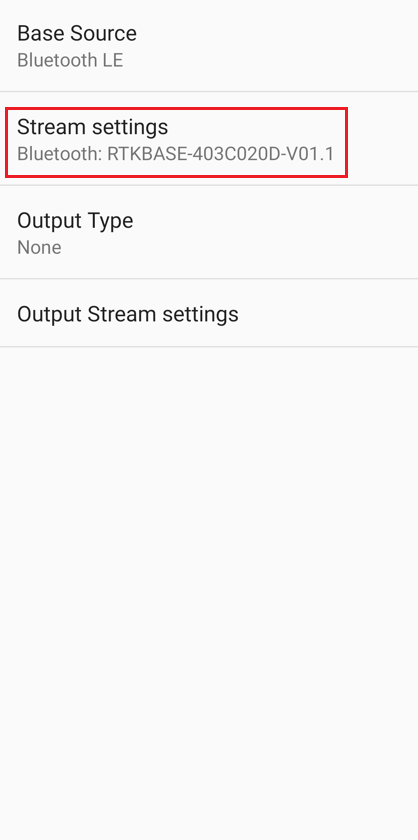
6. Select a GR-9028 labeled “RTKBASE-xxx” under “Bluetooth LE device.”
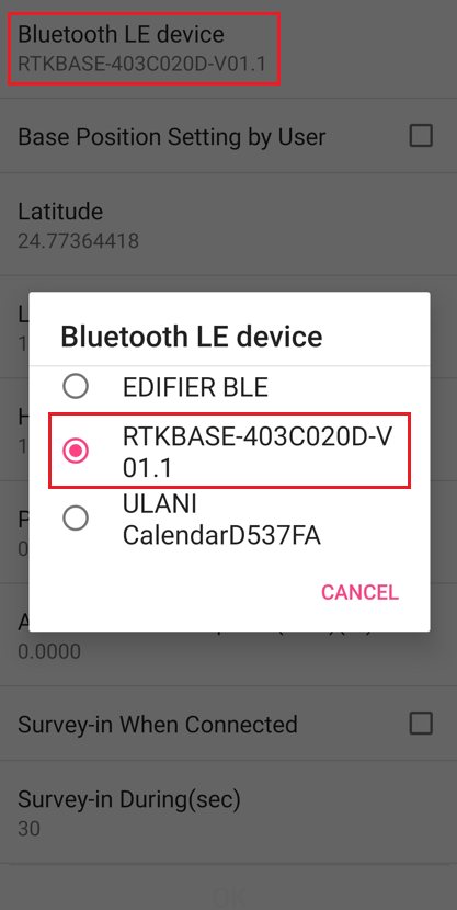
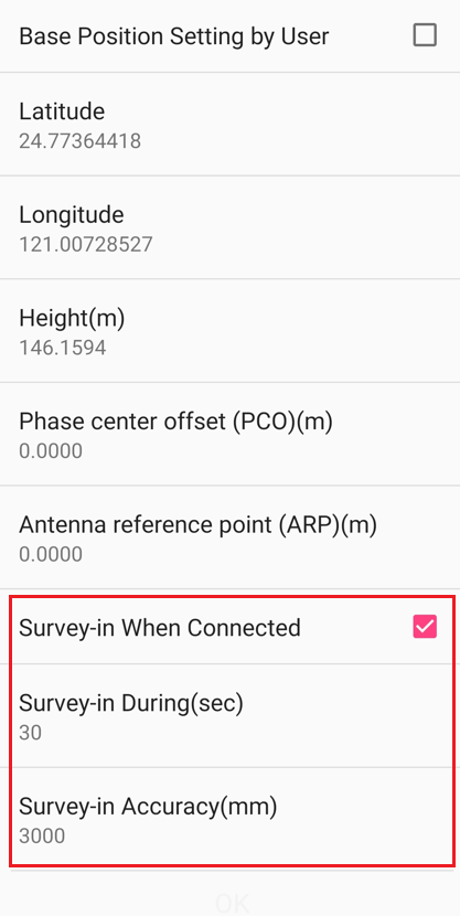
7. On the following screen, you’ll find options for “Base Position Setting by User” or “Survey-in When Connected.”
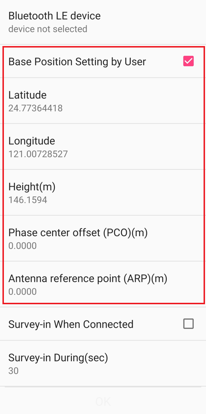
Explain the parameters under “Base Position Setting by User” option:
Note that this function is available starting from firmware V011 released on January 8, 2024. It is not supported in earlier versions.
Terms:
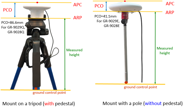
Ground Control Point: A known point with predetermined (latitude, longitude, height) coordinates.
APC (Antenna Phase Center): The average point from which the antenna phase is measured.
ARP (Antenna Reference Point): The access point on the antenna’s lowest horizontal surface.
PCO (Phase Center Offset): The offset between the average APC and ARP.
ARP Height: The height measured from the ground control point to ARP.
Select “Base Position Setting by User,” then input the latitude, longitude, and height (in meters) of the ground control point. Additionally, enter the Phase Center Offset (PCO) value (either 41.1 or 86.6 mm) and the height (in meters) of the Antenna Reference Point (ARP) for adjusting the height between the antenna and the ground control point.
Please note:
- The antenna is positioned above the ground control point.
- Height adjustment ensures accurate positioning of either the antenna or the ground control point.
- For the base (GR-9028), the adjustment involves adding the height (PCO + ARP) to the known ground control point. This adjusted height is then used for broadcasting RTCM correction data.
- If the PCO and ARP values are entered, the new position will be applied accordingly. Specifically, for the base, its height will be the known point’s height plus PCO + ARP.
Explain the parameters under “Survey-in When Connected” option:
When selecting “Survey-in When Connected,” the default survey-in duration is 30 seconds with an accuracy of 3000 mm. For higher accuracy, adjust the accuracy to a smaller value. The survey-in duration represents the minimum time required for surveying.
Navisys RTK GNSS can be purchased from:
https://gpswebshop.com (US & WorldWide)
https://canadagps.ca (Canada)